Geoscience Software
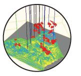
Geoscience is the branch of science dealing with planet earth, including features on the earth’s surface, and below it. In petroleum industry, geoscientists play an important role in finding underground oil and gas reservoirs. They are also involved in mapping and interpreting underground surface interpretation. Today there are a number of advance geophysical software packages available for processing, interpreting and running inversion on reservoir seismic data.
Diamond® - A data processing and integration environment for the 21st century.
With the introduction of our one-of-a-kind Diamond® software platform, Geotrace takes seismic data processing and integration in a whole new direction. This exciting new environment provides the industry’s fastest, most ...
Read More ...

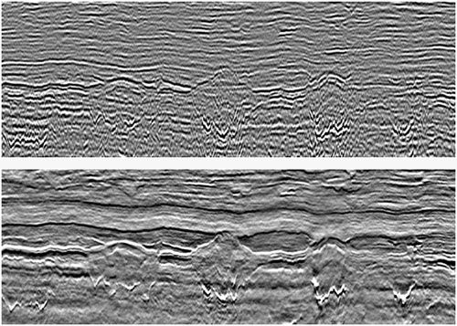
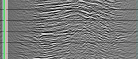
HDBand™ De-ghosting Marine Seismic Data and Broadband Solutions
Geotrace has developed one of the most versatile and flexible suite of techniques to attack the ghost problem generated from the towing of hydrophone arrays and seismic sources in marine seismic acquisition. As is well known in the ind ...
Read More ...
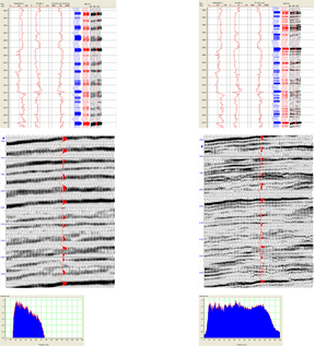
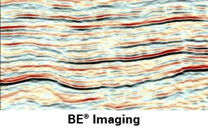
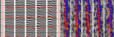
Widess and others have demonstrated that changes in phase and amplitude are evidenced in seismic as a result of beds that are below resolution. Geotrace has developed an algorithm, Bandwidth Extension (BE®), to recover that information more effectively than has ever been done.
BE® utilizes the Cont ...
Read More ...
To find oil and gas in most plays, it is no longer sufficient to interpret from conventional reflectivity seismic. It is vital to know much more about both the rock and fluids before drilling. Geotrace has developed a powerful ROCKIT™ (ROCK-properties Inversion Toolkit) inversion tool box, which inc ...
Read More ...
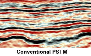
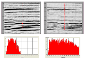
Bandwidth Extension (BE®) has historically been run post-migration and it works very well, but is dependent on the imaging with conventional frequencies.
Running BE® before migration provides an increase in spatial resolution. The improvements come from three sources. First, the increase in the ban ...
Read More ...
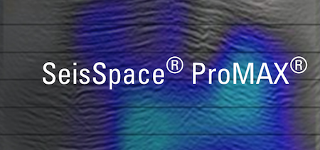
Deliver large volumes of data quickly and accurately
With intuitive analysis tools, state-of-the-art geophysical algorithms and an optimized parallel infrastructure, the SeisSpace® ProMAX® Seismic Processing Software family helps teams get the most out of seismic data, increase productivity, reduce ...
Read More ...
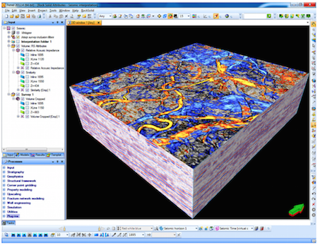
Collaborate across domains quickly and seamlessly
With Landmark’s multi-user workspace and innovative seismic interpretation tools, your team can contribute to a common sealed 3D structural framework while they interpret, then create presentation-quality maps – in minutes.
Accelerate traditional ...
Read More ...

Asset teams are challenged not only to locate and delineate increasingly complex reserves replacement opportunities, but also to find those reserves efficiently, economically and at the lowest risk.
With at-the-wellhead prices in flux and ultra-deep water projects at the edge of economic viability, ...
Read More ...
RSI’s interactive, rock physics and geophysical modeling application (iMOSS) is a powerful and sophisticated tool for reservoir rock physics analysis. It enables interpreters, modelers, and others geoscientists to control an array of parameters so that they may understand the underlying rock and flu ...
Read More ...
With thousands of users, our attributes have a strong following – and with good reason. Our seismic attributes provide interpreters with the information they need as part of their multi-physics workflows. These structural, stratigraphic, and seismic character attributes are now available for Petrel, ...
Read More ...