Geoscience Software
Geoscience is the branch of science dealing with planet earth, including features on the earth’s surface, and below it. In petroleum industry, geoscientists play an important role in finding underground oil and gas reservoirs. They are also involved in mapping and interpreting underground surface interpretation. Today there are a number of advance geophysical software packages available for processing, interpreting and running inversion on reservoir seismic data.


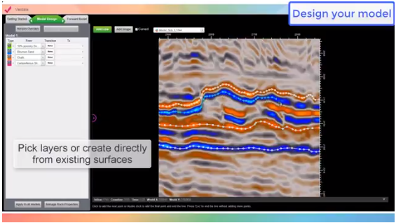
Build your structural models directly within the seismic volume, save time and incorporate all the details from your interpretation.
GeoTeric's modelling functionality allows you to build your models without getting into the (traditional) geocellular domain. Incorporating petrophysical property dis ...
Read More ...
QC and validate all available data, and/or the current hypotheses.
GeoTeric’s Validate module enables you to QC the accuracy of your interpretation and hypotheses. It allows you to test different geological scenarios and fluid/lithology models to de-risk drilling decisions. It provides a better und ...
Read More ...
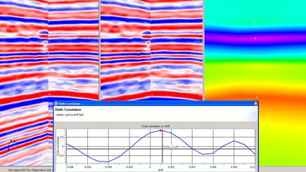
Automated Multi-volume Seismic Registration:
A flexible geophysical tool used for matching two or more seismic volumes for applications targeting: time-lapse reservoir monitoring, azimuthal fracture mapping and multi-component fluid and reservoir characterization.
Supports interactive and automate ...
Read More ...
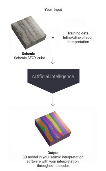

How does it work?
The AI technology is trained for volumetrical interpretation of 3D cubes by learning from traditional manual interpretations of geophysicists. The trained algorithm makes interpretations on seismic 3D cubes. The output integrates with the tools of the geophysicist and assists in h ...
Read More ...
INVERSION TO RESERVOIR PROPERTIES
Estimates of reservoir properties (porosity, lithology and fluids) using seismic data are customarily obtained through seismic inversion in two stages: in the first stage rock properties (P- and S-impedances and density, for example) are computed through elastic in ...
Read More ...

We offer our proprietary software to certain select clients. It can be provided as a plug-in for an existing software package or as a stand-alone. We will provide detailed support to make sure you are able to achieve your desired results. Each software agreement is custom, so please contact us if yo ...
Read More ...

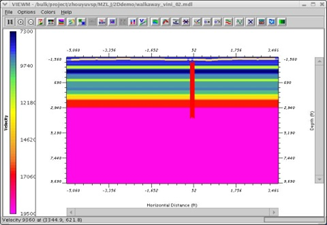
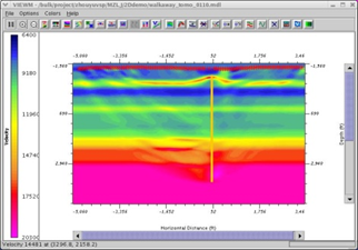
TOMOXPro is the only commercial crosshole software package in the seismic industry. This software package includes crosshole survey design, model building and modeling, data preprocessing, CDP transformation, tomography, wave-equation migration, and post-processing. It simply offers the entire range ...
Read More ...

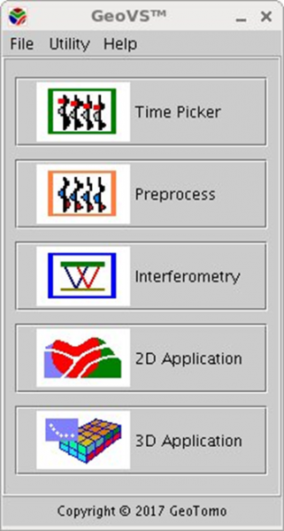
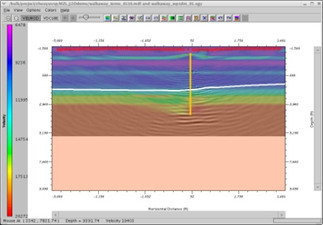
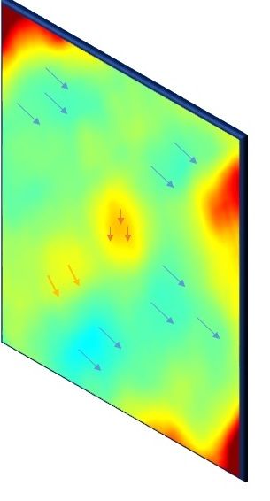
GEOVS™ 2D/3D VSP DATA PROCESSING AND IMAGING
GeoVS™ is a 2D/3DVSP data processing and imaging software program. GeoVS™ offers capabilities including building geometry, picking first breaks, particle motion analysis, orientation, signal processing for 2D and 3D wave field separation (parallel comput ...
Read More ...
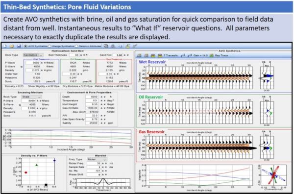
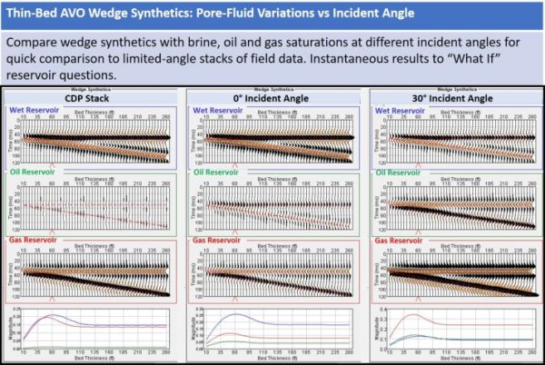
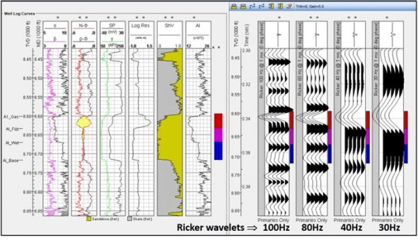
TIPS™ TOOLKIT FOR INTEGRATING PETROPHYSICS TO SEISMIC TIPS™
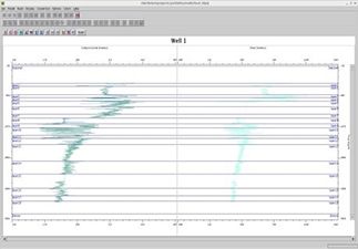
WELL LOG MODELER
Full suite of well-log editing and modeling of 1D and AVO synthetics, wedge models and seismic attributes. Quickly perform seismic well ties with the synthetics generated by TIPS. Understand within minutes the impact of i ...
Read More ...
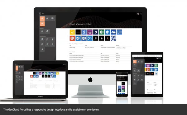
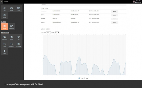
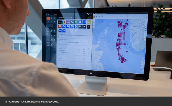
GeoCloud - A cloud solution for oil and gas, renewables, and Ocean Industries
GeoCloud is the only vendor-agnostic petrotechnical cloud solution that facilitates all your applications and data in one collaborative and flexible solution.
Overview
Geology and geophysics (G&G) software and appli ...
Read More ...