Geoscience Software
Geoscience is the branch of science dealing with planet earth, including features on the earth’s surface, and below it. In petroleum industry, geoscientists play an important role in finding underground oil and gas reservoirs. They are also involved in mapping and interpreting underground surface interpretation. Today there are a number of advance geophysical software packages available for processing, interpreting and running inversion on reservoir seismic data.
Quality Well Ties for Better Understanding of Seismic Character
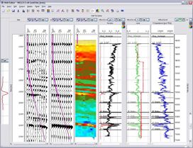
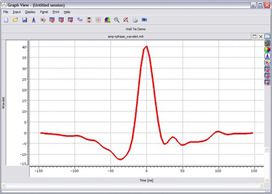
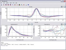
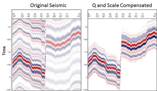
Accurate well-tying and wavelet estimation is a critical step in reservoir characterization. Jason WellTie provides a highly visual and interactive environment for creating, refining and QC'ing wavelets for inversions. With a proper wa ...
Read More ...
Jason has invested a great deal of resources in developing and implementing the most advanced wavelet estimation methods along with a wide variety of QC capabilities to ensure that a high-quality wavelet is obtained.
Accurate wavelet estimation is absolutely critical to the success of any seismic i ...
Read More ...
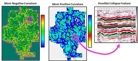
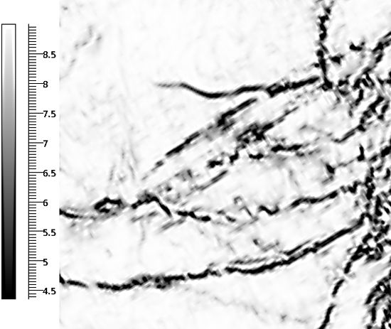
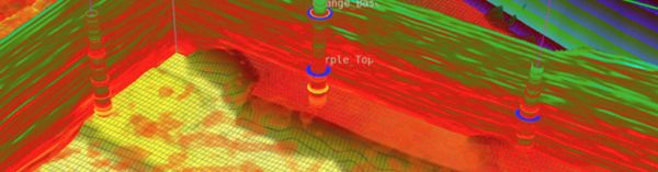
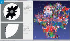
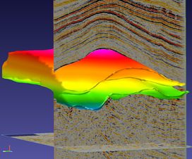
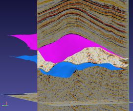
Highlight fracture zones and collapse features
Attributes are conveniently grouped within a single application. These include:
Stratigraphic
Instantaneous
Horizon-based
Layer-based
Spectral Decomposition
Geometric
Coherence
The geometric and coherence attributes incorporate Jason dip-st ...
Read More ...
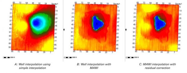
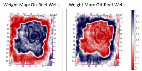
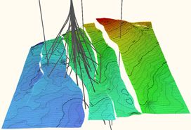
The Multi-Attribute Well Interpolator (MAWI) adds geologically consistent detail to reservoir models by using external trends to drive interpolation of lateral changes beyond well control. This improves reservoir model quality between wells.
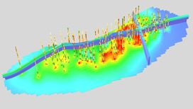
Building Better Low Frequency Models
The MAWI analysis a ...
Read More ...

Environment-Plus (E-Plus) combines the most used tools within the Jason Workbench into a single, tightly integrated foundation for use in performing your structural and quantitative interpretation workflows. Included in this package are the base visualization tools, Body Checking, 2D Interpretation, ...
Read More ...
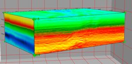
Simultaneous Inversion of P-Wave and Converted Wave Data
Inversion of converted wave data can improve subsurface imaging by improving the quality of the shear impedance result. But the best results come from simultaneously inverting the P-wave and converted wave data together. The RockMC optional a ...
Read More ...

Well Ties and Inversions from Depth Seismic – all with the Convenience of Traditional Time QCs
The Jason® Workbench now supports deterministic workflows with depth seismic inputs. This includes tying wells, estimating wavelets and performing post-stack or pre-stack inversions with Jason InverTraceP ...
Read More ...
Combine all the processes of surface mapping and integrated structural modeling for low frequency modeling. Use the resulting models in inversion workflows. Automatically update models to stay current with new information using a core feature of the software architecture-Updateability.
Fast, Up-to- ...
Read More ...
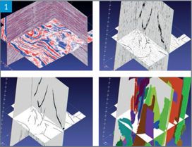
The fastest, most accurate, and most complete automated Fault and Fracture interpretation capability is now available in a single offering – FaultFractureSpark. This InsightEarth module pulls together the technology that was previously available separately into a single package, with workflows that ...
Read More ...
SaltSpark accurately defines salt bodies, no matter how complex or unusual they may be. This innovative solution accurately brings the most complicated structures into clear definition. Iterative migrations run much faster and deliver superior imaging results.
See Where Salt Ends and Pay Zone Begin ...
Read More ...